Friday, November 6, 2015

November 6, 2015 - Jargon

White blazing is hiking the AT, refers to the white painted marks (blazes) along the AT that mark the trail route, usually about 3" by 8" painted on trees and rocks.
Blue blazing is hiking a side trail and skipping some of the AT, refers to the blue blazes used to mark side trails.
Yellow blazing is skipping a section of the AT and hiking or riding on a road, refers to the yellow lines on the road.
Pink blazing is any change in your hiking plan (if you are a male) for the purposes of catching up with or meeting up with a female hiker.

Thursday, November 5, 2015

November 3, 2015 - Pen Mar Park (PA-MD boarder) to I70

Picture of the day
My favorite spot on the whole trip 

AT Total to date:  
     Rockfish Gap, VA to Pennsylvania-Maryland Line. Finished 202.7 of 2189.2 miles (9.3%)

This Report:
      Pen Mar Park to I70

A short 18 mile trip to finish the Maryland AT from Pen Mar Park to I70.
Whoowoo! 2 states finished after this trip, West Virginia was very short.

Day one:
On day one of a planned three day trip, I stayed at the Rocky Run Shelter.
I had a company. A guy named Chris.
And he lives in inner city Baltimore and is a teacher there. He's amazing. ...much more to his story.
At his school the class sizes just got bumped to 45. 
This and other things caused him to quit, that's why he's here on the trail this week.

Day two: after hiking down to Antietam Creek and filling up on water I started to get a sinus headache from all the leaf mold. The trail was covered with leaves making it difficult to hike because I couldn't see the rocks.  I planned a 5 mile day then another 5 mile day then a 9 mile day. At some point during the day I decided to make day 2 the long day instead. As the day progressed I saw that it was only a bit farther to the car (about 4 more miles) and thought since my headache was not going away that I'd really like to go home. That meant that I'd have to do a 14 or 15 mile day. Around about 3pm I gave up on that idea, I was really tired. I settled on camping at Pogo campground. But when I got there it was still light out and I'd recovered my enthusiasm for sleeping at home that night. I ate some caffeine gummies (called Blocks), looked at the map and started the last hill climb. It was only 3.9 miles to the car with mostly flat ground ahead. There is also 2 places to camp in the upcoming stretch so I knew I could camp if I wanted. Well, it was a long tough day but what made it possible for me to finish was how easy the trail became. Flat and no rocks, I just flew along. I finished at 7pm, two hours after sunset.


Pen Mar Park, MD

 
Pen Mar Park, MD
 
Pen Mar Park, MD

Sign at Pen Mar Park, MD

 
A view along the AT between Pen Mar Park and Raven Rock Shelter
 
Raven Rock Shelter 

My Campsite at Raven Rock Shelter

 
 Antietam Creek First and only good water source after Raven Rock Shelter

 Nice Fern Garden

 I fell just after crossing this bridge

 Incredible rock wall in the middle of nowhere

 Some unexpected time in the sun

 A Bucolic Vista

 My favorite spot on the whole trip

 The same grassy field as seen in the picture above

 Pogo Campground at 4:30 pm, sunset at 5pm with over 4 miles to go

 Blackrock Vista
 Another  Blackrock Vista

  My GPS Track

Monday, October 26, 2015

October 25, 2015 Ed Garvey Shelter to Harper's Ferry


Picture of the day
Pink Hat

AT Total to date:  
     Rockfish Gap, VA to I70 Footbridge-US40, MD 184.1 out of 2189.2 miles (8.4%)

This Report:
      Ed Garvey Shelter to Harper's Ferry

s
GPS track of this trip


Ed Garvey Shelter

 Water under my sleeping pad after the rain

Pink Hat spread out a space blanket to capture rain water, she gave me half and saved me a 1 mile round trip to the spring.


Sleeping Loft in Ed Garvey Shelter

Sleeping Loft in Ed Garvey Shelter

Sleeping Platform in Ed Garvey Shelter

Ed Garvey Shelter

Ed Garvey Shelter

Potomac River from the AT side Trail near Harper's Ferry

Turtle

C&O Canal Path

Potomac River 

Steps from C&O canal to bridge over to Harper's Ferry

Bridge from C&O canal to bridge over to Harper's Ferry

Iconic Church in Harper's Ferry

One of the hardest part of the hike was hiking thru Harper's Ferry on a Sunday, all the restaurants were open and the smell was drifting thru the streets driving me nuts. I was waiting to meet Pat for lunch and did not want to eat until then. People were walking around eating large ice cream cones with double scoops of chocolate.

Steps to to the top of the Hill in Harper's Ferry

    The final mile from Harper's Ferry to the Route 340 Bridge was a challenge, I was tired and hungry and trying to make a 2:30 date to meet Pat there. Pat and I drove to the tractor store and bought me a clean t-shirt then went to a sports restaurant for burgers and to watch the Red Skins Game. They Won!


October 24, 2015 MD I70 to Ed Garvey Shelter


Picture of the day

War correspondents memorial

AT Total to date:  
     Rockfish Gap, VA to I70 Footbridge-US40, MD 184.1 out of 2189.2 miles (8.4%)

This Report:
      I70 Footbridge-US40, MD to Ed Garvey Shelter

I snuck away for a 3 day weekend and completed another small section of the AT. This will probably be my last overnight-er until spring.
I'm still having problems controlling my body when really  tired and fed at the end of the day. I start painfully shivering. Probably the worst pain I've felt. It's really hard to bare and to describe.
Friday night I stayed at the rocky run shelter and when i got up to pee I immediately started shivering but two guys had kept the fire going by the shelter and I toasted myself until I stop shivering. I was only wearing a coat over my tee shirt and boxers. The three of us stayed by the fire for almost an hour talking. After that I was fine and the shivering didn't reoccur. The guys told me to tell Pat not to worry because the two of them had kept me warm :)
Saturday I stayed at the Ed Garvey shelter in my tent. A troop of boy scouts were there and while sitting by the fire I enjoyed remembering my days as a scout. I also talked with a 70yo woman that is hiking the AT in several long trips....amazing.    
Later in my tent, I had some shivering try to start again but very minor since I planned for it by getting into bed and eating dinner from there then never getting up all night.
Sunday I'll hike to Harper's Ferry where Pat will pick me up.
I can't really control the order of the pictures below with the app. I'm using....
AT I70 overpass

Rocky Run Shelter

Me with a sinus headache but still happy

Ed Garvey Shelter
With enclosed second floor

David Fortney Shelter

Ed Garvey Shelter

Washington Monument, MD

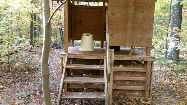
Moldering Privy w/o door

Valley view from Washington Monument 

Wasp nest 

FYI